
Melrose ZIP Code Coverage
Only one current standard postal association was verified in the research. The second number appears in a state insurance statistical source, but its street-delivery role was not confirmed by USPS. That makes it a historical or limited association, not a second citywide slice. Use an address-level postal result when a record has either number. A code is useful for mail routing and address comparison, but it is not a resident roster or a city boundary.
| ZIP | Areas Covered | Post Office | Notes |
|---|---|---|---|
| 02176 | Current standard Melrose postal association; verify each address | USPS Melrose Post Office, 23 Essex Street | Postal and Census reference, not a city boundary |
| 02177 | Melrose association in a state statistical source | Current street-delivery status not verified | Historical or limited association only |
A ZIP code directory is most useful as an address-validation tool. It cannot prove who receives mail or occupies a property, and it should not be read as a list of residents.
Melrose ZIP Code Verification
Use the USPS ZIP Code Lookup in address mode before searching a local record. Street Address and City and State are required; Company and Apt/Suite/Other are optional, and ZIP can be optional by mode. The same tool also accepts a city and state, or a ZIP alone. USPS normalizes an address, which helps resolve format differences, but it does not identify an occupant or prove that a person or business is located there.
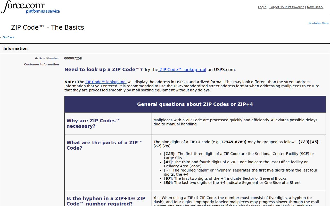
The USPS ZIP Code basics source shown here explains the postal categories behind a returned code.
Save the normalized address exactly as returned, including a unit when one is supplied. Then use the street and number for municipal parcel and records work. ZIP+4 adds delivery-route detail, but it is not an occupancy signal.
| USPS mode | Fields used |
|---|---|
| Address to ZIP | Street, optional company and unit, city, state, optional ZIP |
| City/state | City and state |
| ZIP to city | ZIP |
Melrose ZIP Code Search Steps
No official portal inspected for Melrose supplies a confirmed ZIP-wide resident list. The Patriot property form has no ZIP field, the GIS interface did not expose a confirmed ZIP filter, and the individual voter search requires a person’s name, date of birth, and residential ZIP. Use the ZIP as a validation step, not a mass-search filter.
- Normalize the full address with USPS and record the result date.
- Locate the street and parcel in Melrose GIS for municipal context.
- Use the street number or parcel in the Patriot property card search.
- Follow a recorded-title question to Middlesex South by party, property, book, page, or document number.
- Label each later result by source and date, rather than calling it a ZIP-wide resident match.
Once a ZIP has narrowed the address, the Melrose by-street directory is the appropriate route for the street-level record chain. A street inquiry can be repeated address by address; it is not a single official search across everyone assigned a code.
Melrose ZIP Code Limits
Postal and municipal lines are separate systems. The City Engineer assigns building numbers under the municipal code, while the assessor uses a parcel number and the registry uses legal descriptions. A visible house number, a mailing city, a parcel’s situs, and a deed description may all be useful but are not interchangeable identifiers. No official source exhausted every address where a Melrose postal label might cross a city boundary, so that comparison remains a documented research gap.
Exact postal-city and municipal-boundary mismatches need address-by-address verification. Do not make a blanket claim about every location inside the ZCTA or every address that uses a Melrose mailing city.
Melrose ZIP Code Statistics
The Census ZCTA 02176 profile is a statistical area, not a USPS delivery boundary or a list of named residents. Its 2020 population is 29,817. The 2024 ACS profile reports median household income of $133,953, 62.0 percent with a bachelor’s degree or higher, 12,401 households, and 529 employer establishments. Those aggregate figures describe the ZCTA, not individual addresses, accounts, or households.
The Census ZCTA 02176 profile should be kept separate from a USPS result. One measures a statistical geography; the other standardizes delivery information. Neither creates a delivery-address list or identifies who lives at a property.
Melrose ZIP and Parcel Geography
Local property research begins with the municipal parcel, not the ZIP. The Melrose GIS can provide the mapped street, parcel, zoning, and surrounding geographic context. The Patriot assessor form can then be searched by its available parcel, owner, street, sale, value, building, and land-use paths. The research found no Patriot ZIP field and no confirmed GIS ZIP filter.
Parcel, postal, and legal descriptions serve different jobs. The City Engineer’s building-number assignment helps maintain visible addresses. An assessor card ties municipal assessment information to a parcel. A registry instrument uses a legal description for a recorded-land question. The right next step depends on which of those systems the question concerns, not on a code printed in a mailing address.
Note: Record both the normalized postal result and the parcel identifier when the address will be checked again later.
Melrose ZIP Code 02177 Caveat
02177 appeared with Melrose in a Massachusetts insurance statistical source. The official research did not establish a current citywide USPS street-delivery role for it. Treat that appearance as a limited or historical association until a USPS result for the specific address confirms it. It should not be used as a current demographic slice, a claim that it serves all of Melrose, or a substitute for 02176 in address validation.
Historical start and end dates for the city’s ZIP assignments were not located in the official material reviewed. A historical document bearing 02177 may be worth preserving as part of its own dated record trail, but the address must still be run through current USPS normalization before a present-day postal conclusion is made.
Melrose ZIP Code Terms
Postal terminology is precise, and these definitions keep a ZIP result from promising more than it can show.
- ZIP Code
- A postal routing code used to help direct mail.
- ZIP+4
- An added four digits that supply more delivery-route detail; it is not an occupancy signal.
- PO Box ZIP
- A code used for post-office boxes rather than a general street-delivery area.
- Unique ZIP
- A code assigned to a single high-volume organization or institution.
- ZCTA
- A Census statistical geography that approximates ZIP-related areas but is not a delivery boundary.
Melrose ZIP Code Record Paths
When a local record is missing from a portal, request an existing record rather than asking the city to build a ZIP list. The Melrose public-records portal can route a precise request for a named department, record type, date range, street, or parcel. Massachusetts Public Records Law, G.L. c.66 §10, generally provides ten business days for a response. The city does not have to create a new compilation or release protected fields.
For a person-specific voter-status question, the state form requires name, date of birth, and residential ZIP. It is not a source for a neighborhood or ZIP-wide export. Dated directory and street-list material can be useful for historical work, but it must be labeled as a publication snapshot rather than a current postal result.
Date Melrose ZIP Code Research
Repeatable ZIP work has a short source record: full address submitted, USPS-normalized result, retrieval date, municipal parcel identifier, assessment fiscal year, and the registry document or map date when used. This sequence makes an address-format result distinguishable from a mapped parcel, an assessment snapshot, and a recorded document. It also keeps a known mismatch visible instead of smoothing over it.
For an uncertain building number or an old address, a narrow municipal request can seek an existing City Engineer, map, or record description for a stated street and date range. A ZIP alone cannot answer a title question, identify a resident, or create a public list of occupants. Preserve a redacted or no-record response as part of the research trail.
A dated source label also clarifies how to read a historical directory or street list. Such a document may use a postal city or street form that was accurate when printed, while current USPS normalization can return a different standardized form. Retain both rather than overwriting the older source. The distinction is useful for address history, but it does not make either document an occupancy record.
Melrose ZIP Source Dates
Use a source date for every layer. The USPS result records postal normalization on the day it was checked. The ZCTA profile carries Census population and ACS estimate years. A Patriot card is tied to its fiscal-year assessment display, while a registry result is tied to the recording or plan date. A precinct map can show the date for its own geography, but it does not update a postal boundary or an assessment card. Keeping the dates visible makes conflicting labels understandable rather than misleading.
Save both the original address spelling and the returned postal format. If USPS, a map, and a property card use different forms, compare the street number, unit, and city label without assuming an error or a resident change. The documented gap remains the same: official research did not provide a current block-by-block comparison of Melrose municipal boundaries with every postal ZIP edge. Address-level verification is the accurate route. A date beside each source also prevents a historic 02177 reference from being mistaken for a present delivery result.